
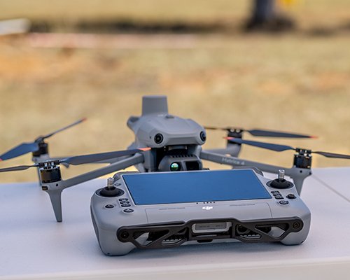
RPA SERVICES
Licensed CASA commercial operator delivering aerial photography, thermal inspection, wildlife surveys, and precision mapping across South East Queensland.
3D & SPATIAL
Gaussian splat and point cloud capture for architecture, heritage, and environmental documentation. Photorealistic 3D — no specialist software required.
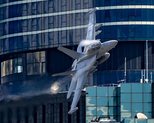
EVENT COVERAGE
Motorsport, aviation, wildlife, and commercial photography. Available for assignment or browse the gallery to license existing work.
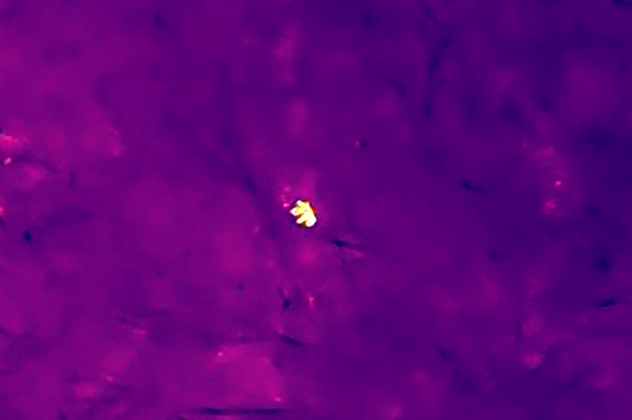
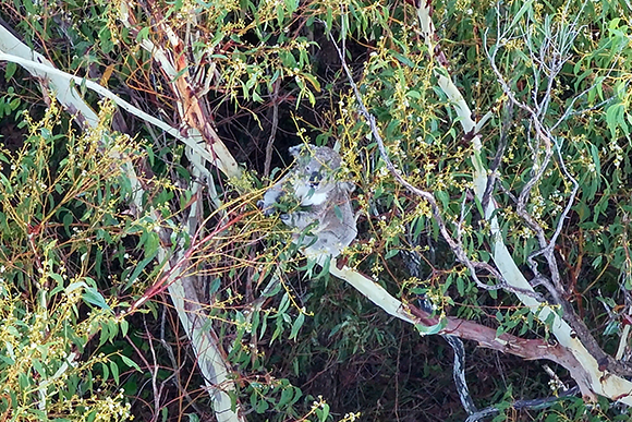
Thermal Detection
Drag to reveal RGB
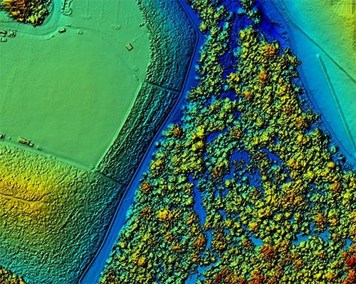
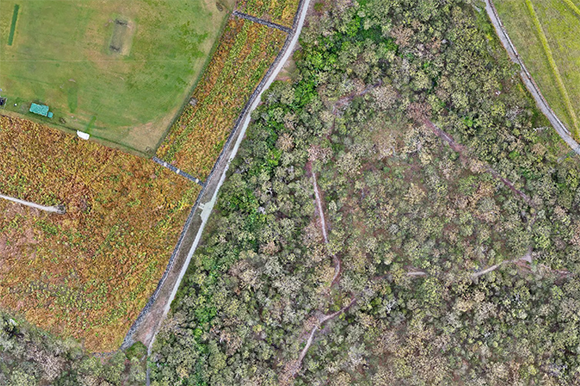
Precision Mapping
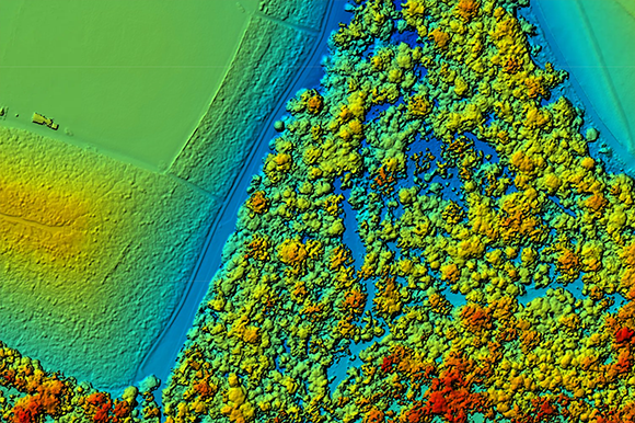
Orthophoto vs Digital Surface
3D Reconstruction
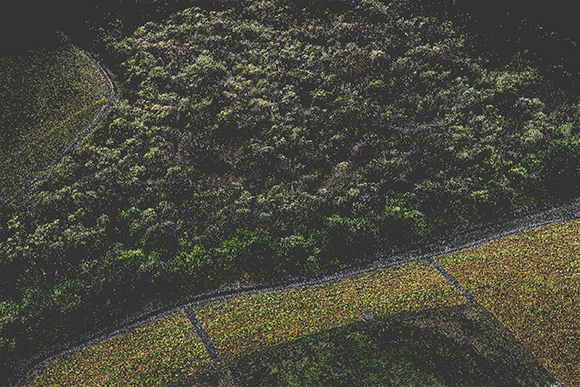
Point Cloud vs Gaussian Splat
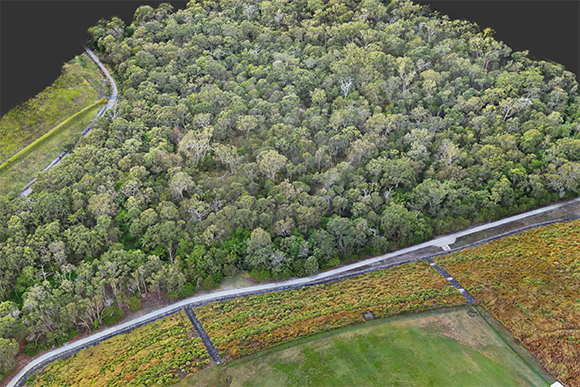
Featured Project
Judy Holt Bushland Reserve
October
2025
Aerial Mapping & Thermal Wildlife Survey — Redlands, SEQ
A 25.7 hectare urban bushland reserve.
One survey program. Complete spatial mapping at 2cm resolution and thermal detection of 20+ fauna species including koala, swamp wallaby, nesting raptors and invasive pest species. This is what modern bushland assessment looks like.